KEESLER AIR FORCE BASE, Miss. -- The Hurricane Hunters of the 53rd Weather Reconnaissance Squadron flew to the southwest quadrant of the Gulf of Mexico June 6 to gather weather data in their first storm reconnaissance mission of the 2014 Atlantic basin hurricane season.
According to Maj. John Brady, an aerial weather reconnaissance officer with the Hurricane Hunters, the forecasters at the National Hurricane Center saw a tropical disturbance in the region and tasked the unit to take a closer look.
"When a storm looks like it might begin to form, the NHC sends us there to gather real-time data. When we get there, we will be looking for a circulation of wind in all four quadrants of the area around the low pressure center," Brady said.
According to reports from the NHC, satellite data showed a 30-knot approximate wind speed.
"If we find that the winds are circulating around the low-pressure center, the NHC could classify this as a tropical depression," Brady said..
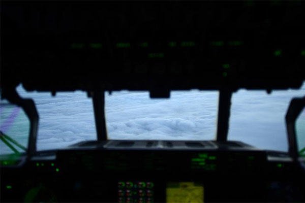
During the infancy of a storm, the hunters fly at very low altitudes to stay under the "weather" at an altitude of 1,000 feet. Once storms increase in intensity, the pilots raise the flight level to 10,000 feet for safety reasons.
The original takeoff for the flight was scheduled for 11 a.m. from Keesler, but shortly into the flight, Brady noticed a fuel leak out of his window and the crew returned to Keesler. The crew then took off in another aircraft at 3 p.m.
According to Lt. Col. John Talbot, the chief meteorologist for the 53rd WRS, the maintenance delay backed up the timeline enough to change the goal of the mission.
"By the time they get down there, it's possible that part of the storm may be over land in Mexico. Their new objective will be a coast patrol mission. They will most likely fly five miles off shore and gather wind speed data," Talbot said.
The Hunters searched for the low-pressure center, but the center was already over land, where it will likely break apart and weaken. The NHC cancelled future flights into the storm system.
After the data was submitted to the NHC, they issued an update regarding the status of the storm based upon the information gathered by the 53rd WRS.
"Surface observations and reports from an Air Force Reserve reconnaissance aircraft indicate that the center of the low-pressure system near Vera Cruz is just inland," according to the NHC release. "However, some chance for development still remains because the center is very near the coast and a slow and erratic motion is possible overnight. Regardless of whether any development occurs, this system will continue to produce gusty winds and heavy rains, along with life-threatening flash floods and mud slides, over portions of southeastern and eastern Mexico during the next day or two."
Although the first storm of the season didn't grow into a named storm system, Brady said he saw this as an opportunity to get back into the swing of things.
After the winter, Brady said there is always anxiety associated with the first storm of the season.. "I use the first storm to clean out the cobwebs and my comfort level comes back. After this one, I feel prepared for the rest of the season."
 moon rocket with the Orion spacecraft slowly rolls back towards the Vehicle Assembly Building at the Kennedy Space Center, Wednesday, Feb. 25, 2026, in Cape Canaveral, Fla. (AP Photo/John Raoux)")
")
")
")
")
")
 emerges from the ice after performing a vertical surfacing to kick off Operation ICE CAMP 2026, Mar. 7. (U.S. Navy Photo)")
.")
.")


")
")
.")
")
")
 crew members observe the cutter from a 26-foot Cutter Boat-Large (CB-L) in the Ross Sea during Operation Deep Freeze 2026, Feb. 21, 2026. (U.S. Coast Guard photo by Petty Officer 2nd Class Christopher Bokum)")
")